Trust us. We know Vancouver
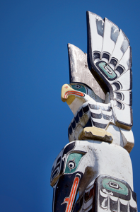 It is a destination and a starting point. Explore Vancouver’s shops and museums, tour its highlights: Granville Island, Stanley Park, English Bay, Second Beach, Gastown, Chinatown and Yaletown. Visit Capilano Suspension Bridge and Park; take the SkyRide to the top of Grouse mountain to observe grizzlies in summer and ski in winter.
Fly to hidden lakes or kayak in False Creek. Take a tour bus to Whistler and fly back by float plane or tour back by bus and experience the natural beauty along the Sea to Sky highway. Fly from downtown Vancouver to downtown Victoria by float plane and return by ferry. In Victoria, visit the Butchart Gardens, drink tea at the Empress or experience the exhilaration of whale watching.
Back in Vancouver, board the Rocky Mountaineer train to the Canadian Rockies, or train across Canada. Catch a cruise ship to Alaska or Amtrak to Seattle then by Amtrak to Portland and points south.
Make the most of this magical city, situated on the edge of the ocean and the mountains. Enjoy its urban forests, green buildings, fresh air, clean water, rich culture, friendly people, great food and safe streets. Visit once. Return often. You’re always welcome.